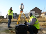
For a reliable and accurate result it is really important the 3D
laser scanning is carried out by professional people with a
thorough land surveying knowledge. To produce a model based on a
point cloud it is even important to have a thorough knowledge of
the standards used in the concerned sector. For example
architecture, industry, etc.
Teccon offers an efficient and accurate data acquisition due to
years of experience in surveying and 3D laser scanning. Teccon
makes use of several scanners so that for each project the most
suitable scanner can be used. For the preparation of detailed plans
and 3D models Teccon disposes of CAD-designers with different
specializations.
Click here to
contact our 3D laser scanning team.

 3D Laser scanning of the Ezelpoort in Bruges
 3D model of the customs office in Sydney
 3D Laser scanning off the PALL tunnel
 3D Laser scanning of a villa
 3D laserscanning of an historical building
